
Thank you for supporting this site ❤️
Make a donation
Make a donation
Morawaka topographic map
Click on the map to display elevation.
Thank you for supporting this site ❤️
Make a donation
Make a donation
About this map
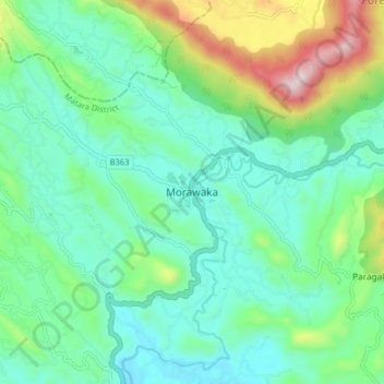
Name: Morawaka topographic map, elevation, terrain.
Location: Morawaka, Matara District, Southern Province, 81470, Sri Lanka (6.22127 80.45175 6.30127 80.53175)
Average elevation: 194 m
Minimum elevation: 23 m
Maximum elevation: 701 m
Thank you for supporting this site ❤️
Make a donation
Make a donation
Other topographic maps
Click on a map to view its topography, its elevation and its terrain.