
Le Carbet topographic map
Interactive map
Click on the map to display elevation.
About this map
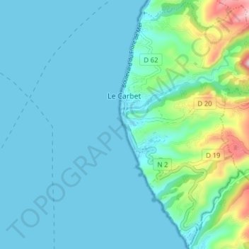
Name: Le Carbet topographic map, elevation, terrain.
Location: Le Carbet, Saint-Pierre, Martinique, 97221, France (14.67530 -61.18466 14.73516 -61.12165)
Average elevation: 63 m
Minimum elevation: 0 m
Maximum elevation: 418 m