
Haflong topographic map
Interactive map
Click on the map to display elevation.
About this map
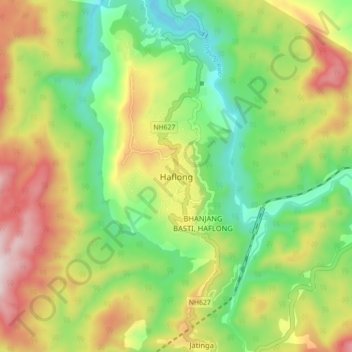
Name: Haflong topographic map, elevation, terrain.
Location: Haflong, Cāchār, Dima Hasao district, Assam, India (25.12914 92.97539 25.20914 93.05539)
Average elevation: 606 m
Minimum elevation: 295 m
Maximum elevation: 1,046 m