
Thank you for supporting this site ❤️
Make a donation
Make a donation
Fairland topographic map
Click on the map to display elevation.
Thank you for supporting this site ❤️
Make a donation
Make a donation
About this map
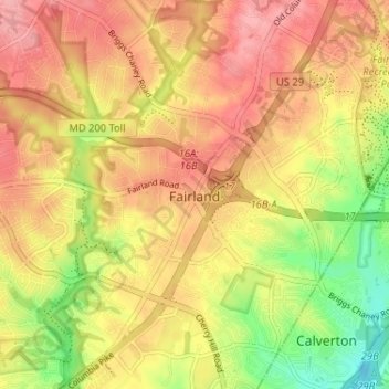
Name: Fairland topographic map, elevation, terrain.
Location: Fairland, Montgomery County, Maryland, United States (39.05127 -76.98117 39.10146 -76.92385)
Average elevation: 115 m
Minimum elevation: 58 m
Maximum elevation: 152 m
Thank you for supporting this site ❤️
Make a donation
Make a donation