
Thank you for supporting this site ❤️
Make a donation
Make a donation
Nukus topographic map
Click on the map to display elevation.
Thank you for supporting this site ❤️
Make a donation
Make a donation
Nukus
The most recent study was conducted in 1998 during the educational field archaeological practice of the Department of History of the NGPI named after Azhiniyaza. The topography of the settlement was studied, and an 18 m2 room was excavated in the early medieval part. A human burial was opened, and bones were found inside a small ceramic molded vessel of the humcha type. It was covered with a brick, possibly taken from the ancient wall of the settlement.
Thank you for supporting this site ❤️
Make a donation
Make a donation
About this map
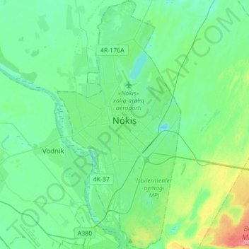
Name: Nukus topographic map, elevation, terrain.
Average elevation: 79 m
Minimum elevation: 63 m
Maximum elevation: 135 m
Thank you for supporting this site ❤️
Make a donation
Make a donation