
Handa topographic map
Interactive map
Click on the map to display elevation.
About this map
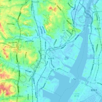
Name: Handa topographic map, elevation, terrain.
Location: Handa, Aichi Prefecture, Japan (34.85897 136.86560 34.94175 136.97828)
Average elevation: 15 m
Minimum elevation: -4 m
Maximum elevation: 77 m