
Thank you for supporting this site ❤️
Make a donation
Make a donation
Las Palmas topographic map
Click on the map to display elevation.
Thank you for supporting this site ❤️
Make a donation
Make a donation
About this map
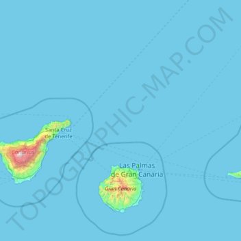
Name: Las Palmas topographic map, elevation, terrain.
Location: Las Palmas, Canary Islands, Spain (27.73458 -15.83465 29.41606 -13.33201)
Average elevation: 43 m
Minimum elevation: 0 m
Maximum elevation: 3,562 m
Thank you for supporting this site ❤️
Make a donation
Make a donation
Other topographic maps
Click on a map to view its topography, its elevation and its terrain.