
Myrtle Beach topographic map
Click on the map to display elevation.
About this map
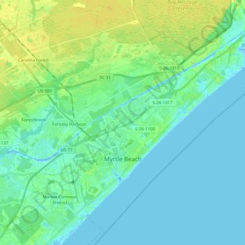
Name: Myrtle Beach topographic map, elevation, terrain.
Average elevation: 6 m
Minimum elevation: -5 m
Maximum elevation: 16 m
Other topographic maps
Click on a map to view its topography, its elevation and its terrain.
Garden City Beach
United States > South Carolina > Horry County > Garden City Beach
Average elevation: 4 m