
Thank you for supporting this site ❤️
Make a donation
Make a donation
Canillas de Aceituno topographic map
Click on the map to display elevation.
Thank you for supporting this site ❤️
Make a donation
Make a donation
Canillas de Aceituno
Canillas de Aceituno has an altitude of around 524 meters at the foot of the Sierra de Tejeda and is crowned by the peak of La Maroma at 2,068 meters, the highest in the province. It is a town of narrow streets that are immaculately whitewashed, Moorish arches and corners of flowers.
Thank you for supporting this site ❤️
Make a donation
Make a donation
About this map
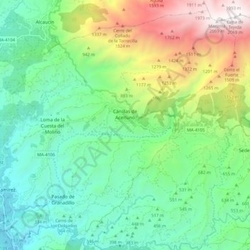
Name: Canillas de Aceituno topographic map, elevation, terrain.
Location: Canillas de Aceituno, La Axarquía, Malaga, Andalusia, Spain (36.83309 -4.13762 36.90618 -4.03815)
Average elevation: 677 m
Minimum elevation: 63 m
Maximum elevation: 2,068 m
Thank you for supporting this site ❤️
Make a donation
Make a donation