
Thank you for supporting this site ❤️
Make a donation
Make a donation
Fushimi Ward topographic map
Click on the map to display elevation.
Thank you for supporting this site ❤️
Make a donation
Make a donation
About this map
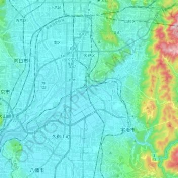
Name: Fushimi Ward topographic map, elevation, terrain.
Location: Fushimi Ward, Kyoto, Kyoto Prefecture, Japan (34.87492 135.70317 34.97718 135.87844)
Average elevation: 79 m
Minimum elevation: 0 m
Maximum elevation: 572 m
Thank you for supporting this site ❤️
Make a donation
Make a donation