
Thank you for supporting this site ❤️
Make a donation
Make a donation
Marl topographic map
Click on the map to display elevation.
Thank you for supporting this site ❤️
Make a donation
Make a donation
About this map
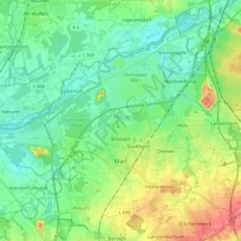
Name: Marl topographic map, elevation, terrain.
Location: Marl, Kreis Recklinghausen, North Rhine-Westphalia, Germany (51.61495 7.02266 51.72033 7.20563)
Average elevation: 53 m
Minimum elevation: 25 m
Maximum elevation: 119 m
Thank you for supporting this site ❤️
Make a donation
Make a donation