
Waterville topographic map
Interactive map
Click on the map to display elevation.
About this map
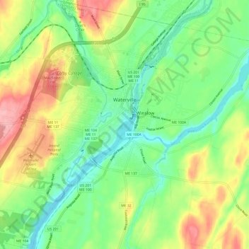
Name: Waterville topographic map, elevation, terrain.
Location: Waterville, Kennebec County, Maine, United States (44.50048 -69.71988 44.58621 -69.60574)
Average elevation: 54 m
Minimum elevation: 7 m
Maximum elevation: 127 m