
Lavínia topographic map
Interactive map
Click on the map to display elevation.
Lavínia
Lavínia is a municipality (município) in the state of São Paulo in Brazil. The population is 12,285 (2020 est.) in an area of 538 km2. The elevation is 458 m. The main activities are related to the production of coffee.
About this map
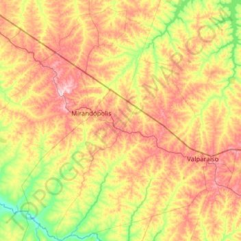
Name: Lavínia topographic map, elevation, terrain.
Average elevation: 385 m
Minimum elevation: 277 m
Maximum elevation: 518 m
Other topographic maps
Click on a map to view its topography, its elevation and its terrain.
Jardim São Lourenço
Brazil > São Paulo > Região Metropolitana de São Paulo > São Paulo
Average elevation: 790 m
São Paulo
Brazil > São Paulo > Região Metropolitana de São Paulo > São Paulo
São Paulo is in Southeastern Brazil, in southeastern São Paulo State, approximately halfway between Curitiba and Rio de Janeiro. The city is on a plateau placed beyond the Serra do Mar (Portuguese for "Sea Range" or "Coastal Range"), itself a component of the vast region known as the Brazilian Highlands,…
Average elevation: 785 m