
Ayotlán topographic map
Interactive map
Click on the map to display elevation.
Ayotlán
Ayotlán is located at coordinates 20 ° 20 '05 "to 20 ° 37' 30" north latitude and 102 ° 15 '00 "102 ° 39' 40" west longitude at an altitude of 1.630 meters above sea level. The town is bordered on the north by the municipalities of the Atotonilco El Alto, Arandas and Jesús María, on the east by the municipalities of Jesús María, Degollado the south by the municipality of Yurécuaro the west by the municipalities of La Barca and Atotonilco El Alto.
About this map
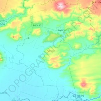
Name: Ayotlán topographic map, elevation, terrain.
Location: Ayotlán, Región Ciénega, Jalisco, Mexico (20.33466 -102.46474 20.60996 -102.21935)
Average elevation: 1,699 m
Minimum elevation: 1,528 m
Maximum elevation: 2,366 m