
Telluride topographic map
Interactive map
Click on the map to display elevation.
About this map
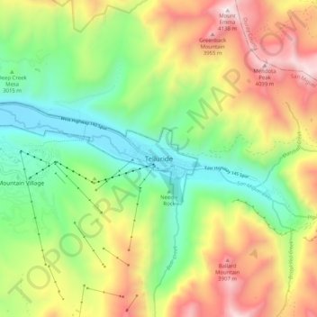
Name: Telluride topographic map, elevation, terrain.
Average elevation: 3,246 m
Minimum elevation: 2,638 m
Maximum elevation: 4,135 m
Telluride has an elevation of 8,750 feet (2,670 m) in an isolated spot in Southwest Colorado. From the west, Colorado Route 145 is the most common way into Telluride; two other passes enter the town, Imogene Pass and Black Bear Pass.