
Thank you for supporting this site ❤️
Make a donation
Make a donation
Pedurungan topographic map
Click on the map to display elevation.
Thank you for supporting this site ❤️
Make a donation
Make a donation
About this map
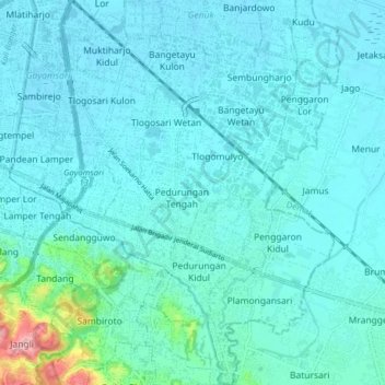
Name: Pedurungan topographic map, elevation, terrain.
Location: Pedurungan, Semarang, Central Java, Java, Indonesia (-7.04064 110.44928 -6.96259 110.50498)
Average elevation: 19 m
Minimum elevation: 3 m
Maximum elevation: 145 m
Thank you for supporting this site ❤️
Make a donation
Make a donation