
Kasaragod topographic map
Interactive map
Click on the map to display elevation.
About this map
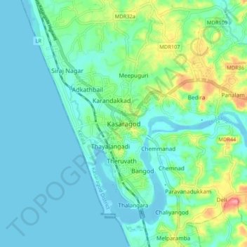
Name: Kasaragod topographic map, elevation, terrain.
Location: Kasaragod, Kasaragod District, Kerala, 671121, India (12.46356 74.95070 12.54356 75.03070)
Average elevation: 19 m
Minimum elevation: -3 m
Maximum elevation: 89 m
Other topographic maps
Click on a map to view its topography, its elevation and its terrain.