
Schwendau topographic map
Interactive map
Click on the map to display elevation.
About this map
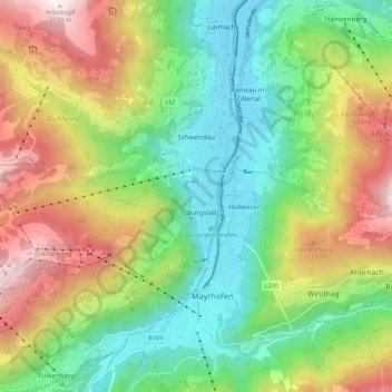
Name: Schwendau topographic map, elevation, terrain.
Location: Schwendau, Schwaz, Tyrol, Austria (47.16735 11.76401 47.20414 11.87107)
Average elevation: 1,163 m
Minimum elevation: 578 m
Maximum elevation: 2,122 m