
Chakan topographic map
Interactive map
Click on the map to display elevation.
About this map
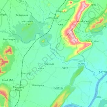
Name: Chakan topographic map, elevation, terrain.
Location: Chakan, Uniara Tehsil, Tonk District, Rajasthan, 325009, India (25.74599 76.19618 25.81029 76.36115)
Average elevation: 248 m
Minimum elevation: 189 m
Maximum elevation: 489 m
Other topographic maps
Click on a map to view its topography, its elevation and its terrain.
Fatehganj
India > Rajasthan > Uniara Tehsil
Fatehganj, Uniara Tehsil, Tonk District, Rajasthan, 322001, India
Average elevation: 276 m