
Kanjirapuzha topographic map
Interactive map
Click on the map to display elevation.
About this map
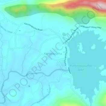
Name: Kanjirapuzha topographic map, elevation, terrain.
Location: Kanjirapuzha, Mannarkad, Palakkad, Kerala, 678591, India (10.97216 76.51228 11.01216 76.55228)
Average elevation: 126 m
Minimum elevation: 63 m
Maximum elevation: 554 m
Other topographic maps
Click on a map to view its topography, its elevation and its terrain.