
North Las Vegas topographic map
Interactive map
Click on the map to display elevation.
About this map
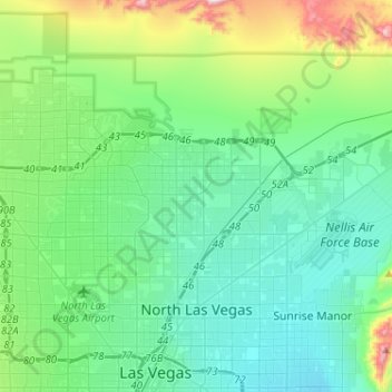
Name: North Las Vegas topographic map, elevation, terrain.
Location: North Las Vegas, Clark County, Nevada, United States (36.18483 -115.21202 36.33589 -114.95455)
Average elevation: 684 m
Minimum elevation: 527 m
Maximum elevation: 1,307 m
Other topographic maps
Click on a map to view its topography, its elevation and its terrain.
Enterprise
United States > Nevada > Clark County > Sloan
Enterprise, Sloan, Clark County, Nevada, United States
Average elevation: 773 m
Riverside
United States > Nevada > Clark County > Mesquite
Riverside, Mesquite, Clark County, Nevada, United States
Average elevation: 483 m
Paradise
United States > Nevada > Clark County
Paradise, Clark County, Nevada, United States
Average elevation: 685 m
Las Vegas
United States > Nevada > Clark County
Las Vegas, Clark County, Nevada, United States
Average elevation: 756 m