
Thank you for supporting this site ❤️
Make a donation
Make a donation
el Castell de Guadalest topographic map
Click on the map to display elevation.
Thank you for supporting this site ❤️
Make a donation
Make a donation
About this map
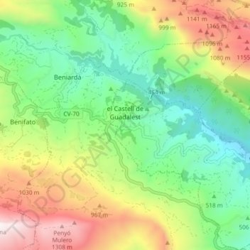
Name: el Castell de Guadalest topographic map, elevation, terrain.
Average elevation: 671 m
Minimum elevation: 228 m
Maximum elevation: 1,406 m
Thank you for supporting this site ❤️
Make a donation
Make a donation
Other topographic maps
Click on a map to view its topography, its elevation and its terrain.
Penyagolosa
Spain > Valencian Community > Castelló / Castellón > Xodos / Chodos
Average elevation: 1,417 m