
Thank you for supporting this site ❤️
Make a donation
Make a donation
Lewis County topographic map
Click on the map to display elevation.
Thank you for supporting this site ❤️
Make a donation
Make a donation
About this map
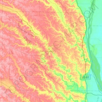
Name: Lewis County topographic map, elevation, terrain.
Location: Lewis County, Missouri, United States (39.94516 -91.95291 40.25724 -91.43537)
Average elevation: 189 m
Minimum elevation: 141 m
Maximum elevation: 231 m
Thank you for supporting this site ❤️
Make a donation
Make a donation
Other topographic maps
Click on a map to view its topography, its elevation and its terrain.
Thank you for supporting this site ❤️
Make a donation
Make a donation
Downtown Kansas City
United States > Missouri > Jackson County > Downtown Kansas City
Average elevation: 271 m