
Thank you for supporting this site ❤️
Make a donation
Make a donation
El Ferrol topographic map
Click on the map to display elevation.
Thank you for supporting this site ❤️
Make a donation
Make a donation
About this map
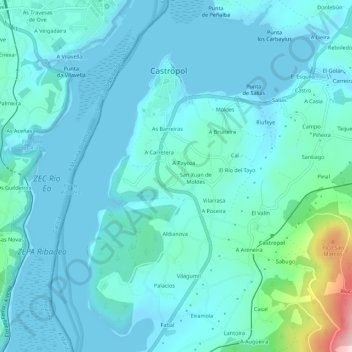
Name: El Ferrol topographic map, elevation, terrain.
Location: El Ferrol, Castropol, Asturias, 33769, Spain (43.49564 -7.04884 43.53564 -7.00884)
Average elevation: 39 m
Minimum elevation: -2 m
Maximum elevation: 302 m
Thank you for supporting this site ❤️
Make a donation
Make a donation